I had Claude Code with Fable create a small scrollytelling map for my 14-minute walk experience at Bagmane Capital in Bangalore.
I used this as an opportunity to explore the current status of the technology. ChatGPT suggested:
- Try ArcGIS StoryMaps first for a polished scrollytelling story.
- Try Google Earth Projects if this is primarily something you will present live, like a map-based slide deck.
- Use MapLibre GL JS with a coding agent if you want precise choreography, animated routes, unusual visual effects, or an asset you can continually extend.
None of these fit my requirements, which was:
- Hostable, self-contained, on GitHub Pages
- Forever free tiles, to the extent possible
Based on its recommendations, my workflow was:
- Capture locations in Google Maps. Right-click and copy the latitude, longitude.
- Capture routes in Google My Maps. This was insight. MyMaps lets you export driving, walking, and cycling routes as KML. (No bike routes, though.)
- Create a single-page index.html using MapLibre GL JS with a free OpenFreeMap basemap.
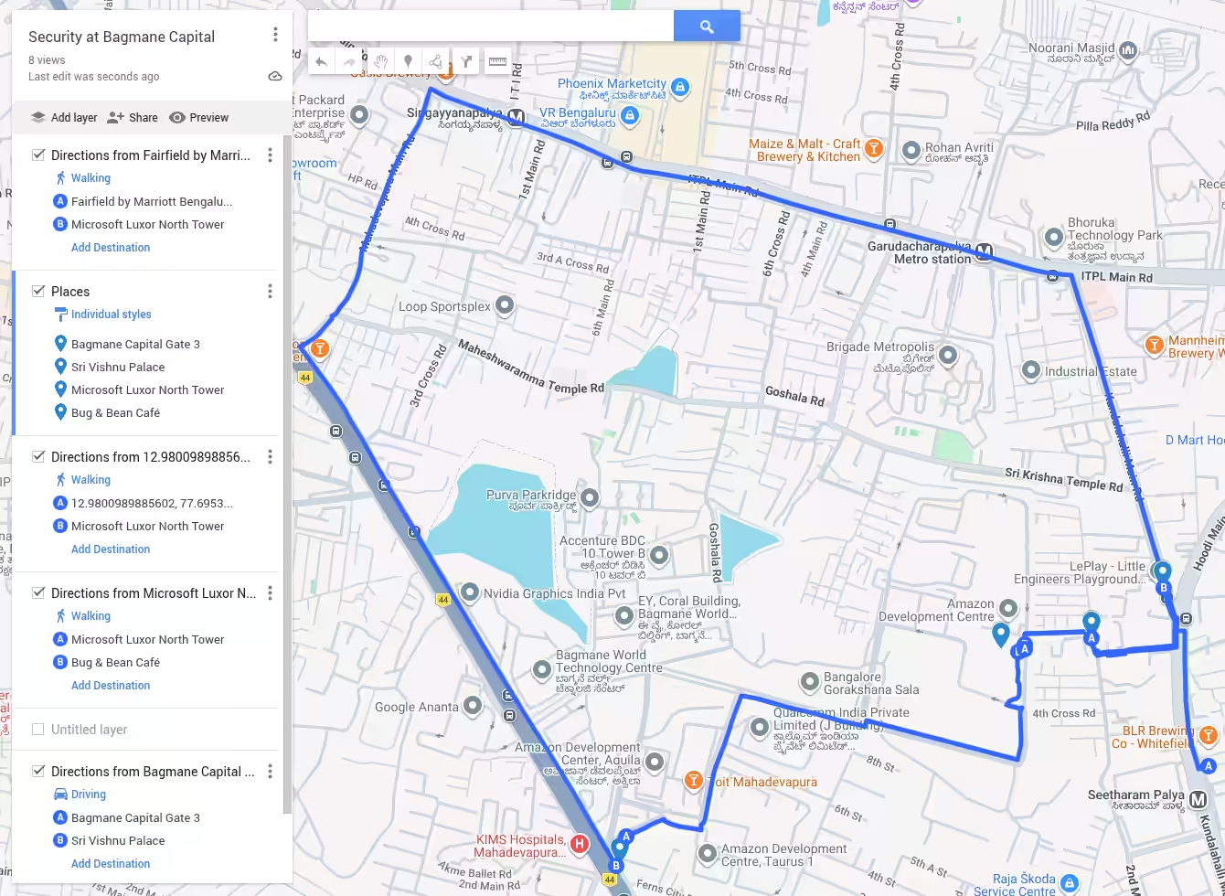
… exported layers as KML files, and meta-prompted Codex with my story written in this form:
I was staying at [The Curzon Court, Brigade Road](https://maps.app.goo.gl/ArHn75eAihHzZXcr9). 12.97454856819103, 77.60788450296555

I needed to be at [Microsoft Luxor North Tower](https://maps.app.goo.gl/Tf5qZGwXogetSJr46) 12.984402817080221, 77.70407412470264
for a 2 pm [workshop](https://hasgeek.com/fifthelephant/when-data-is-for-agents-workshop/).

So I came over to [Seetharampalya Metro Station](https://maps.app.goo.gl/Z4deFUzZsqamcCZC9) 12.98116461318051, 77.70872373073122
and seated myself at [Fairfield by Marriott](https://maps.app.goo.gl/NJqUfFnHL4QW8xa2A) 12.981961760138114, 77.70869689674738
by 11 am.

...
… and also attached a series of .kml files for the routes. The generated prompt had some nice suggestions, such as:
- Break the story into well-paced scenes, preserving its dry, escalating humour.
- Make time pressure visible through restrained clocks, timestamps, distance and ETA annotations.
- Build tension toward the late arrival, then treat the security confrontation with deadpan repetition.
- End quietly and anticlimactically at Bug & Bean with the peri peri paneer sandwich.
- … etc.
But one interesting idea I didn’t explore was to “Have the coding agent add an authoring mode”, specifically:
In authoring mode:
- Clicking the map copies
[longitude, latitude]. - Copy camera copies the current center, zoom, bearing and pitch.
- Copy visible bounds copies southwest and northeast coordinates.
- Import KML/GeoJSON previews routes.
- Selecting a route offers Create fit chapter.
- Clicking a marker offers Create point chapter.
- A panel shows the exact chapter JSON.
- Pressing
Ccopies the current camera. - Pressing
Pcreates a placemark. - Pressing
Bcreates a fit-to-bounds instruction.
This is a great idea - fairly easy to implement, meaning that I can even do away with map authoring software in the future.
AI agents write software, but also know what software features are useful. That makes taste more niche (i.e. I’ll use / buy your software if I already know and totally align with your taste, but otherwise, I’ll mix-and-match and build my own.)