2026 3

Creating a scrollytelling map

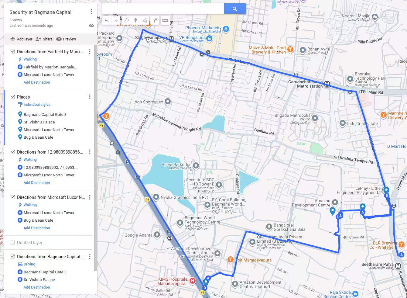
I had Claude Code with Fable create a small scrollytelling map for my 14-minute walk experience at Bagmane Capital in Bangalore. I used this as an opportunity to explore the current status of the technology. ChatGPT suggested: Try ArcGIS StoryMaps first for a polished scrollytelling story. Try Google Earth Projects if this is primarily something you will present live, like a map-based slide deck. Use MapLibre GL JS with a coding agent if you want precise choreography, animated routes, unusual visual effects, or an asset you can continually extend. None of these fit my requirements, which was: ...

Things I Learned - 22 Mar 2026

This week, I learned: Psychological operations in design by Narendra Ghate When lights are dimmed people speak softer. So, dimming lights reduces sound levels in noisy offices. Rather than reduce the size of shampoo sachets (which customers and business both hate), include 2 shampoos in one sachet, tearable in the middle. Price saches at 95p with a 5p deposit for the sachet - which rag-pickers can collect and return to the retailer. People think of stains like wounds on cloth. So a “stain band-aid” where you stick a strip, and remove it after 5 min to remove the stain, is catchy. A mechanical wind-up fish that stirs the water in the bucket while clothes are soaking speeds up the process. Senthil & Amutha, founders of Payir demonstrated a re-usable fabric calendar that converts into a bag for re-use. Pretty clever! Their message at the Chennai Design Festival was that good design can be for the masses and by the masses to reclaim their time, energy, and joy. The urinary bladder works based on involuntary muscular contractions towards the end, to clear out the last bits of fluid. It’s not fluid flow, it’s muscle contractions. (Oh, the things I learn!) Gemini Indigo bans ghee in cabin baggage. Also coconuts, pickles, oily foods, gooey cakes, spices (masala, powders), strong-smelling food. ChatGPT New skill unlocked: how to demo without knowing what you’re demo-ing. STEP 1: Copy-paste all demo pages as Markdown. STEP 2: Tell AI “Here is a demo I’ll be showing. (Add context.) Tell me how I should explain this and what I should point out as specific examples. Use concise bullets.” We’ve learnt not to do things we don’t know how to (until we learn it). When AI is doing things, this is a bottleneck. Get out of the way. Stop filtering for what YOU can do. Stop learning what IT can do. Ask for it. That’s faster. Learning can come later. I keep forgetting that QR codes need a white border for them to work. TerraDraw provides a unified API across multiple mapping libraries. (In the vibe-coding era, this is not as useful.) To create desktop apps declaratively on Linux, Slint, Flutter, QML(Qt) and GTK4 are options. Slint and Flutter seem to be cross platform. Slint is newer, less mature but compiles to small fast binaries and might be a good option to explore. Flutter seems more mature and fairly popular. Claude PyTorch Tracing watches one forward pass and freezes the path into a portable recipe. But it silently ignores branches your example didn’t take. Claude The Internet is forking into a human internet vs an agent web LinkedIn SamGeo is a Python Package for geospatial image processing. While OlmoEarth provides geospatial embeddings, SamGeo can convert geospatial data to vector data! So you can do things like: Create the outer boundary of all apartments with swimming pools in a city Extract the shape of all lakes across the years to find out how they’re changing. Terence started Foundation for Science and AI Research (SAIR) to use AI in science research. Verifiable proofs (e.g. LEAN) are a big part of this. Since AI needs to run on phones and that needs GPUs, a lot of phones might need replacement in the next few years.

Mapping The Red Headed League

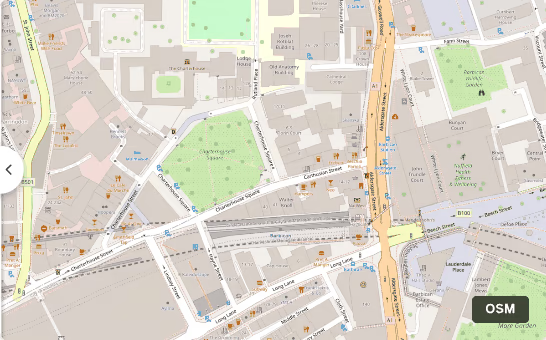
Mapping The Red Headed League is a fascinating reconstruction of the actual places mentioned (or hinted at) by Arthur Conan Doyle’s The Red Headed League by Aman Bhargava. We cross-reference railway timetables, scrutinize Victorian newspaper reports and historical incidents, scour government records, analyze meteorological data, and, in my specific case, pore over Ordnance Survey maps to make the pieces fit. What struck me is how little London has changed, how much old data is available, and what love it takes to reconstruct such a journey! ...

2007 1

GPS and Google Earth

How to use a GPS with Google Earth and map your path. Which is also a way to use your laptop and any GBP 30 GPS receiver to create a GBP 100 GPS navigator.

2006 1

Google Earth Chennai

Chennai on Google Earth in high resolution. Mylapore and other areas near the coast are not yet in hi-res, though.

2005 8

A9.com Maps

A9.com Maps. Provides photos of building elevations of location!

Nokia GPS and Google Maps

Mobile Google Maps with GPS.

Google Earth Released

Google Earth released. It’s free. Related links: Google Earth Hacks Comments S Anand 1 Jul 2005 12:13 pm: It shows my house. Ram 1 Jul 2005 4:16 pm: At my first sight i thought that this picture was taken from simsity game.I coudn’t imagine that this picture from Google maps are real !!! S Anand 4 Jul 2005 5:00 am: It gets better than SimCity. You can tilt the view of a city and fly by the skyline on Google Earth.

Google Maps API

Google Maps API. But for some reason, it doesn’t work on Geocities. Related links: Google Maps Mania, London Traffic (and cameras)

Google Earth

Google Earth = Google + Keyhole.

Google Maps UK

Google Maps, UK. I’m thrilled!

Surprises in satellite maps

Surprises lurk in satellite maps. Like the tsunami hitting Sri Lanka, an erupted volcano, bombing at Baghdad, etc.

Google Maps

Google Maps. Only has the US for now. But that may change, given that not to mention that google has been primarily focused on the u.s. market and is now turning their full attention to the global marketplace. The interface, as always with Google, is fantastic. This is the way to go for Web applications. via Google Blogoscoped. Comments m1108061928989 9 Feb 2005 12:00 pm: Actually, google maps produced better routes too (more intuitive or just plain luck in my case ) but 2 consecutive routes cant be coincidence S Anand 9 Feb 2005 12:00 pm: Their database may be from Keyhole, whom they acquired recently. I didn’t see anything from India on it, though. Sathish 9 Feb 2005 12:00 pm: This is an interesting way to comment.. TOPFRAME 9 Feb 2005 12:00 pm: their interface is pretty good.. but, I wonder if they could do the maps of India in the same manner..

2003 1

GeoURL

Experimenting with GeoURL. It also gives an interesting perspective of blog usage, geographically.

2002 1

Music helps identify software bugs

Music helps identify software bugs. I’m sure it can be extended to many other forms of ordered data. DNA sequences, time series, etc.